Tuesday, November 29, 2005

Cape Cod in the Summer of 2005 - part 1

A short 2 hour bus ride from Boston on June 6, 2005 brings me to the ferry that takes vehicles and people to the port of Vineyard Haven in the district of West Tisbury on the holiday resort island of Martha's Vineyard. It is a picturesque island a little smaller than Penang island where I grew up. It has quaint little communities spread all over what used to be an island where fishing was the major occupation before tourists discovered it's idyllic charms.


Seafood here is really fresh and good and one of the highlights was tucking into a 3 pound lobster just off the jetty of a small fishing village called Menemsha. Fog often obscures the best views and is something islanders have become used to.


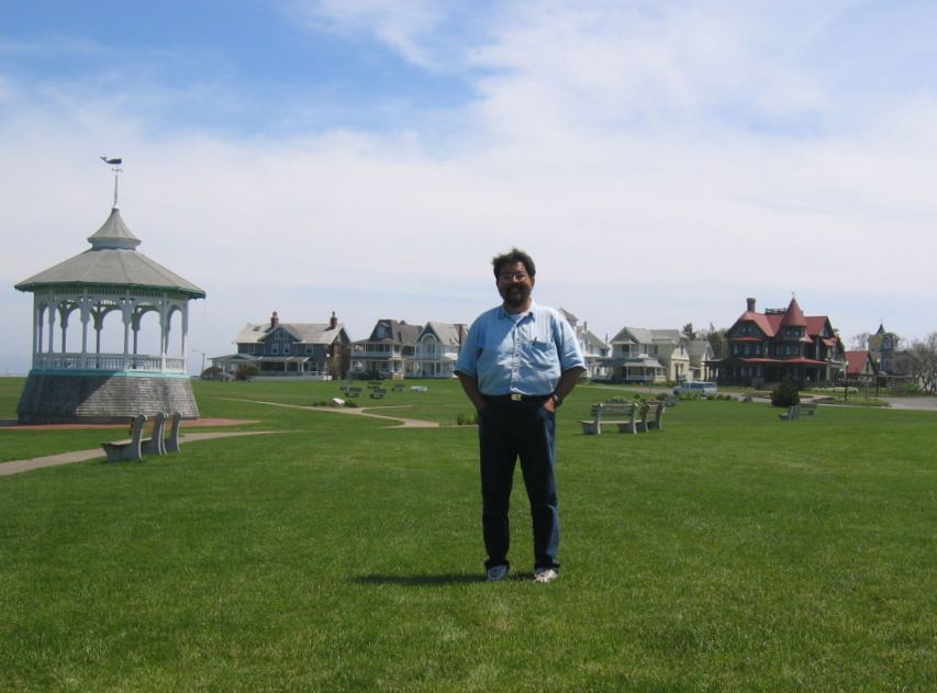
There are fabulous houses built by wealthy people all over Martha's Vineyard and the ones behind me on Oak Bluffs are some of the older ones. There are far more elaborate ones and some with modern designs tucked away along the quieter parts of the island - many of which have private beaches which are a pain for the regular person.


Not exactly a massive airliner that one gets on to get from Martha's Vineyard airport to the neighbouring island of Nantucket which in many respects is like Martha's Vineyard but smaller, quieter and more deeply steeped in history.


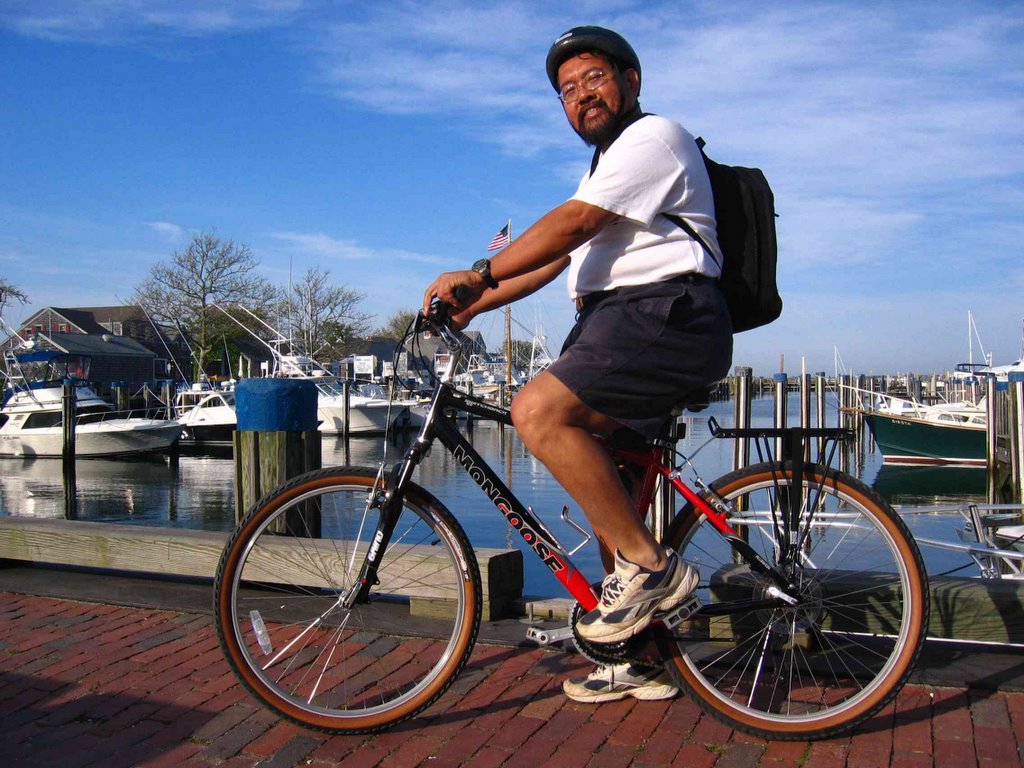
One of the best ways to get around the Cape and Nantucket island in particular is a sturdy comfortable bicycle. The Mongoose I am riding is a rental.

The beautiful old harbour in the background is where much of the maritime activity starts from.


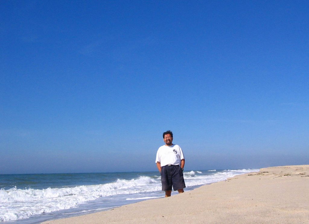
The Atlantic ocean on a relatively calm day. On the first day I arrived on Nantucket, the ocean was rough and with a strong wind blowing, white caps graced the wild ocean scene.

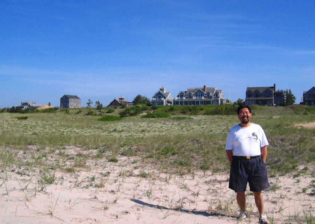
The old Lifeguard Station is one of the houses in the background just behind Surfside beach. It is now a comfortable youth hostel.

Sunday, November 13, 2005

Climb up Mount Kinabalu


Climbed up Mount Kinabalu, the highest peak on the island of Borneo and throughout this little corner of the world with 8 other members of the Sabah Society on October 25, 2005.


The picture on the right is taken from a lower region in Kundasang to the east of the mountain shortly after sunrise. Although the South peak can be clearly seen on the left of the picture, Low's peak is not visible. The climb is usually done over two days.


A total of 17 of us started off from the Timpohon gate of Kinabalu National Park on the first day which was mostly of glorious sunshine in the earlier part, gradually turning cloudy in the afternoon and then rainy in the evening.


On the way up we passed through forests of gnarled oak trees that have been shaped by a combination of altitude, climate and weather. This forest is almost always smothered in a cloud or mist and sunlight penetration is probably compromised on most days.


A little higher where there are fewer trees, shrubs and berries abound. The change in
vegetation types is quite apparent as one ascends every 2,000 metres or so above sea level.


What was particularly attractive on the ascent up the mountain were the lovely and varied orchids, pitcher plants, rhododendrons and other beautiful plants.


A view of the mountain from Panar Laban. The view on the left was taken on the morning of our ascent by the very helpful Maimee Scott, a very committed member of the Sabah society.


After Panar Laban and past the Sayat Sayat check point, one gets to see the really elegant South peak which can be reached on a different trail from this point. This trail is not so well marked and a separate permit from the Park headquarters is however required.

Getting lost on the mountain is a real possibility that must be taken very seriously. This has in the past resulted in several fatalities and in some cases, the bodies have yet to be recovered.


A view of Low's peak from the south-east. The thick white rope which is a very clear guide to the base of the peak is essential when climbing up (or down) in darkness on in thick fog which often reduces visibility to around only 3 metres. If separated from this rope and their guide, climbers are warned NOT to proceed on their own but to use a whistle or loud voice to call for help.


At last after a steep ascent on the second morning of the climb, we get up to the summit of Low's peak which is the highest point on the mountain. There are several peaks on this massive hunk of granite and other interesting ones are the South peak, Victoria peak and St. John's peak.

Well you'd have to be a real intrepid climber to do all of the other peaks because at this point I am feeling rather sore in the knees!